
Every question has four options and the right one is marked. The shape rounds are gentle for children who have just learned the prefectures and still a little tricky for adults who have studied the atlas for years. The border round is the hardest. Read the questions aloud, show them on a screen, or run the whole thing live on everyone's phones.
Create the quiz
Create a free account, choose "Generate with AI" and type "Japanese prefecture quiz for elementary school, 12 questions". You can also enter the questions below yourself and keep only the rounds you like.
Press "Start game"
A PIN appears on the screen. Players open sheelon.me/join on a phone, tablet or laptop and type the PIN. No app and no player account needed.
Go at your own pace
You decide when each question starts. Shape questions work well on a big screen, where everyone says "hmm, where is that?" together. The leaderboard updates after every answer.
Silhouette quiz: which prefecture is this shape?
6 shape questions
Which prefecture is this shape?
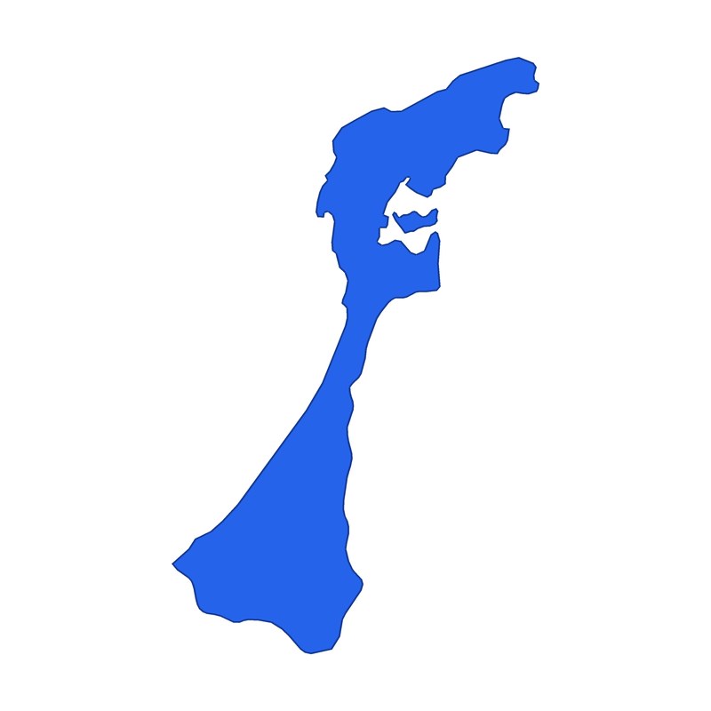
Which prefecture is this shape?
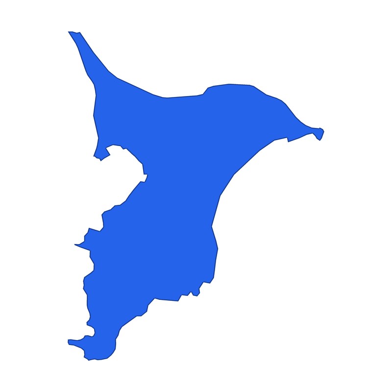
Which prefecture is this shape?
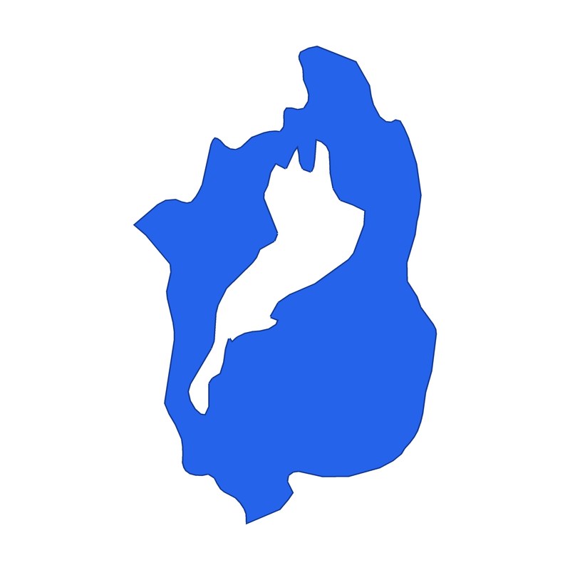
Which prefecture is this shape?
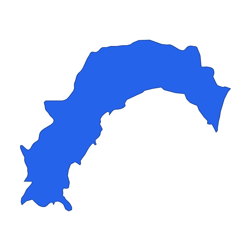
Which prefecture is this shape?
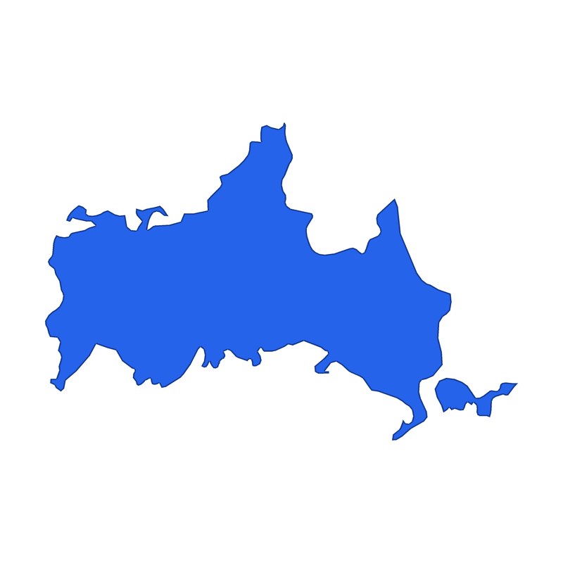
Which prefecture is this shape?
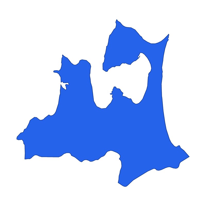
Start by looking for the obvious features: a peninsula, a bay, a lake. In a shape question, the parts that stick out or dip in are better clues than the overall outline.
Which one is the shape of this prefecture? Pick from four
6 shape-picking questions
Which one is the shape of Ibaraki?
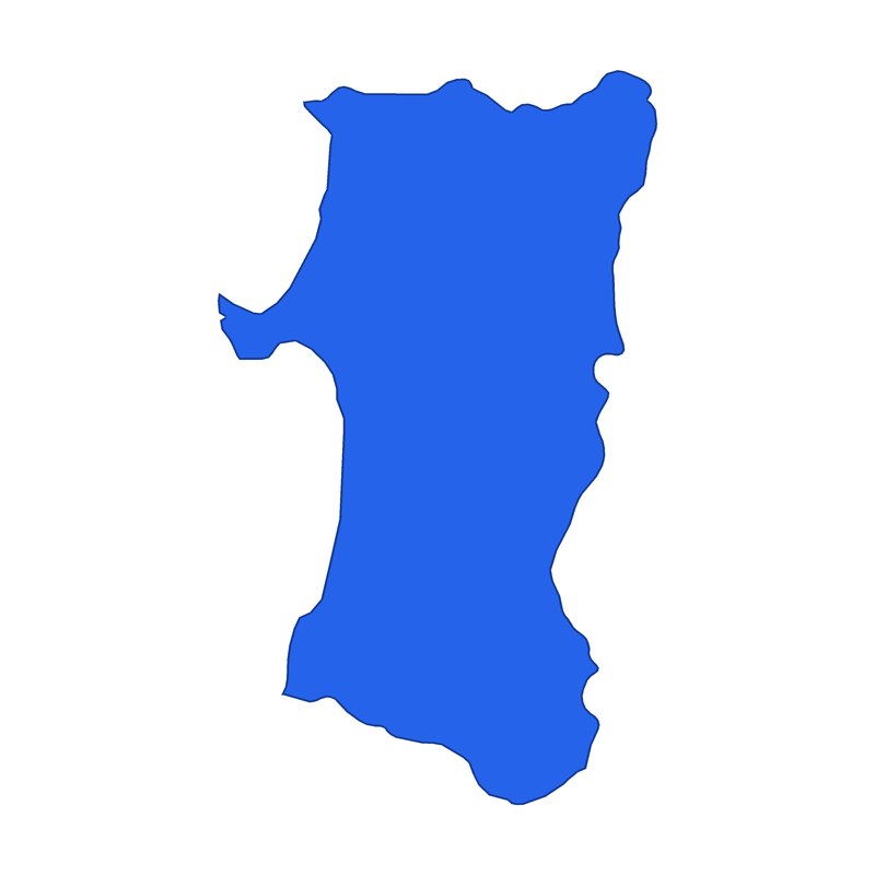 Akita
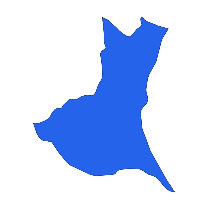 Ibaraki
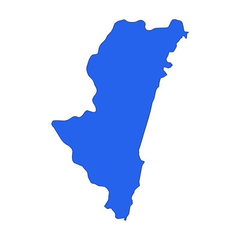 Miyazaki
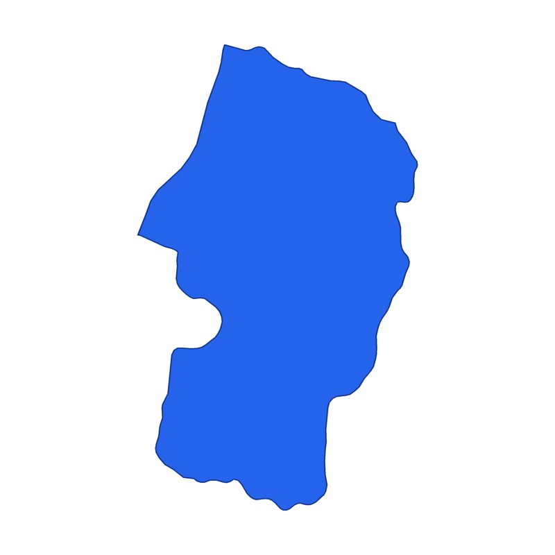 Yamagata
Which one is the shape of Kanagawa?
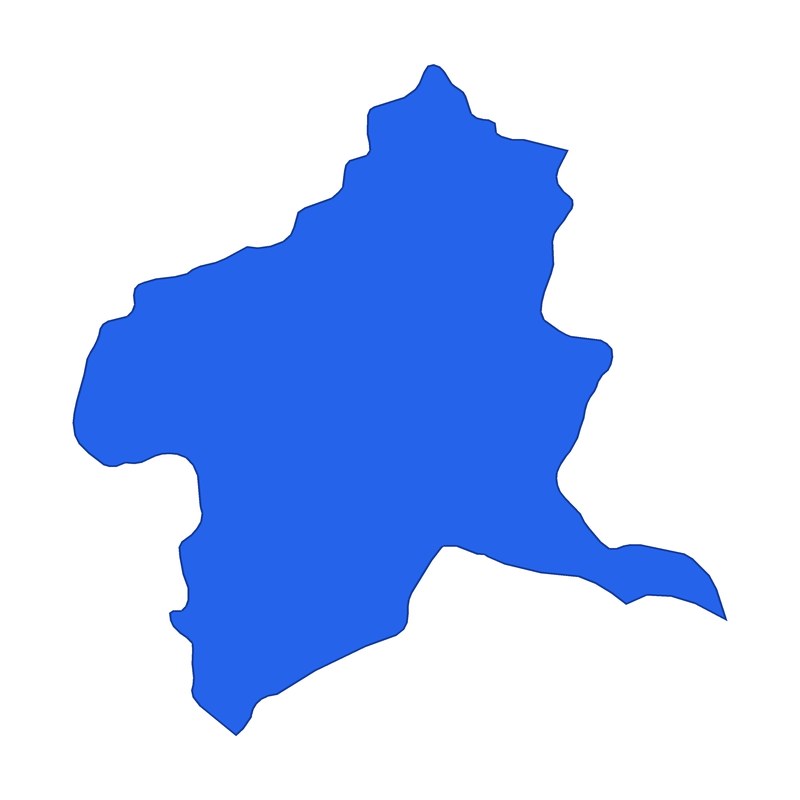 Gunma
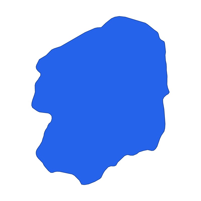 Tochigi
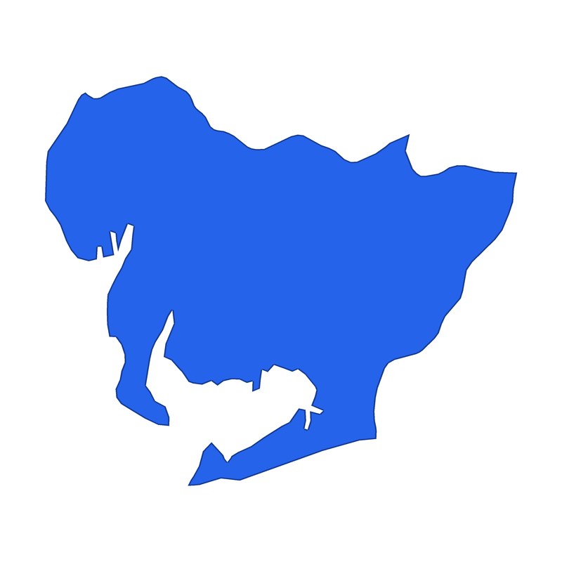 Aichi
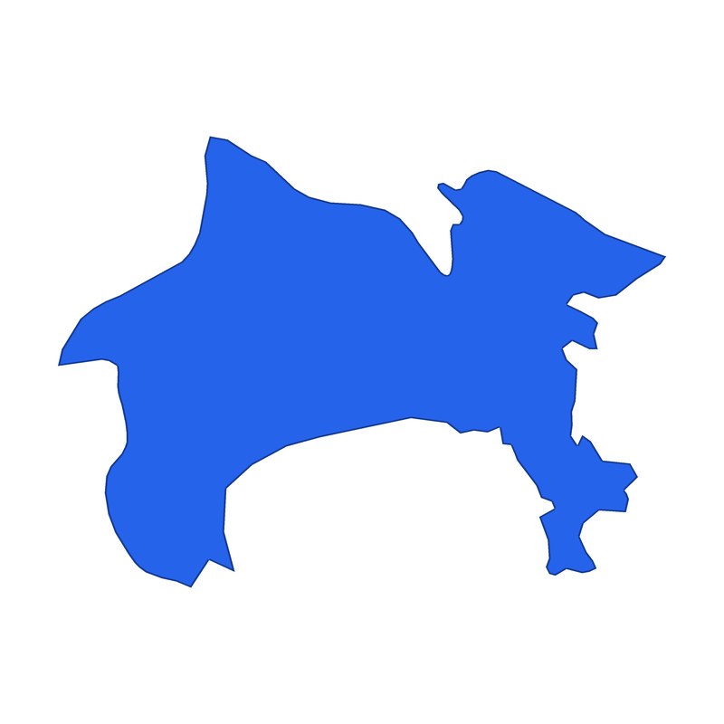 Kanagawa
Which one is the shape of Gifu?
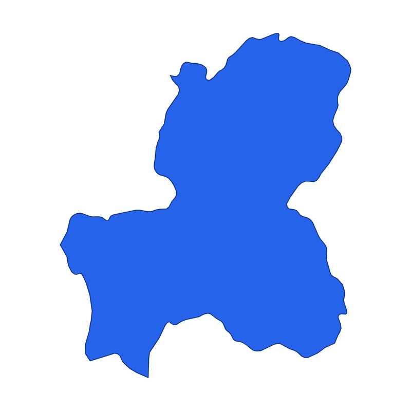 Gifu
- Aichi
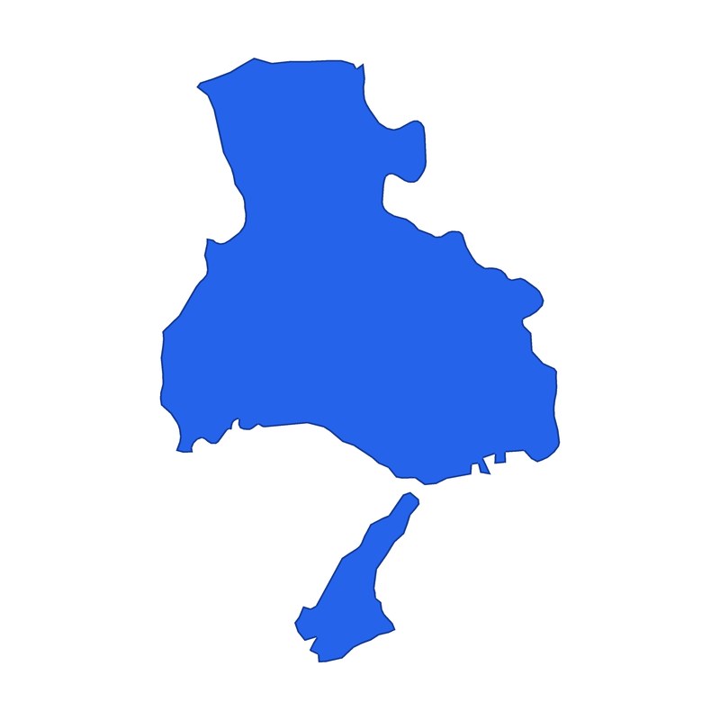 Hyogo
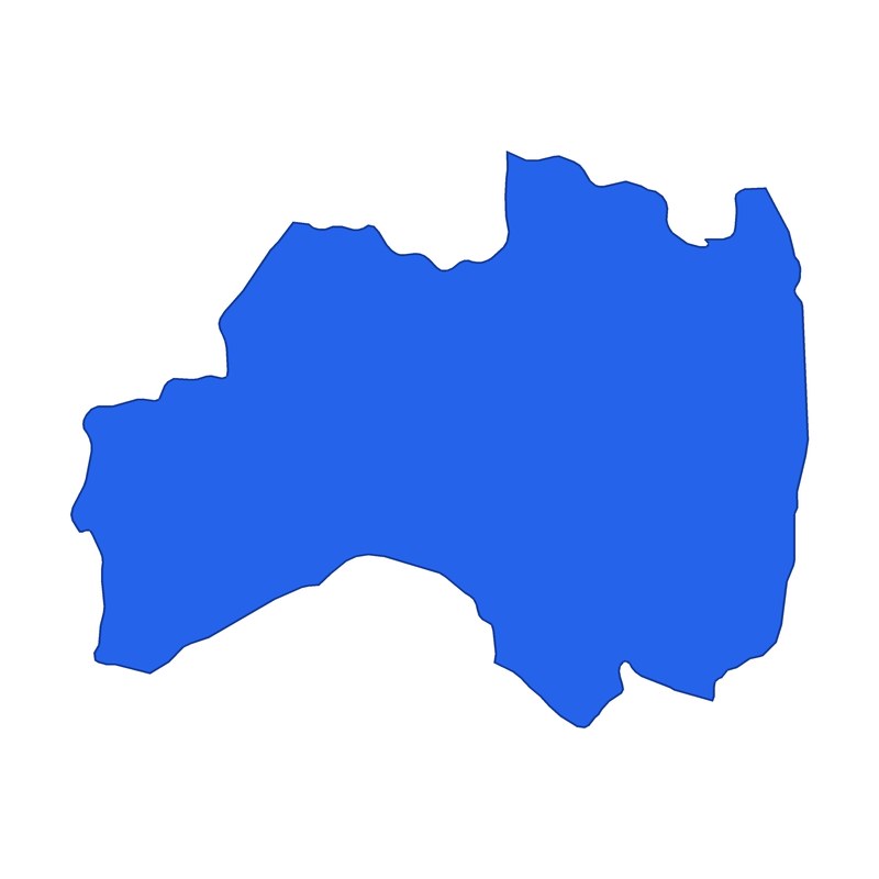 Fukushima
Which one is the shape of Okinawa?
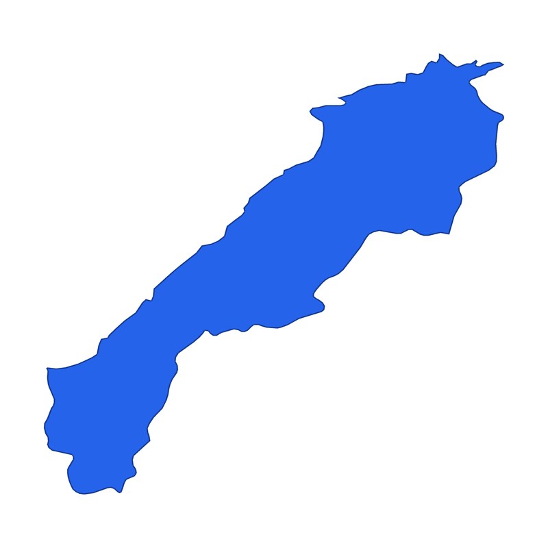 Shimane
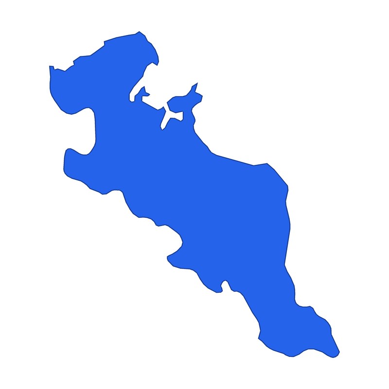 Kyoto
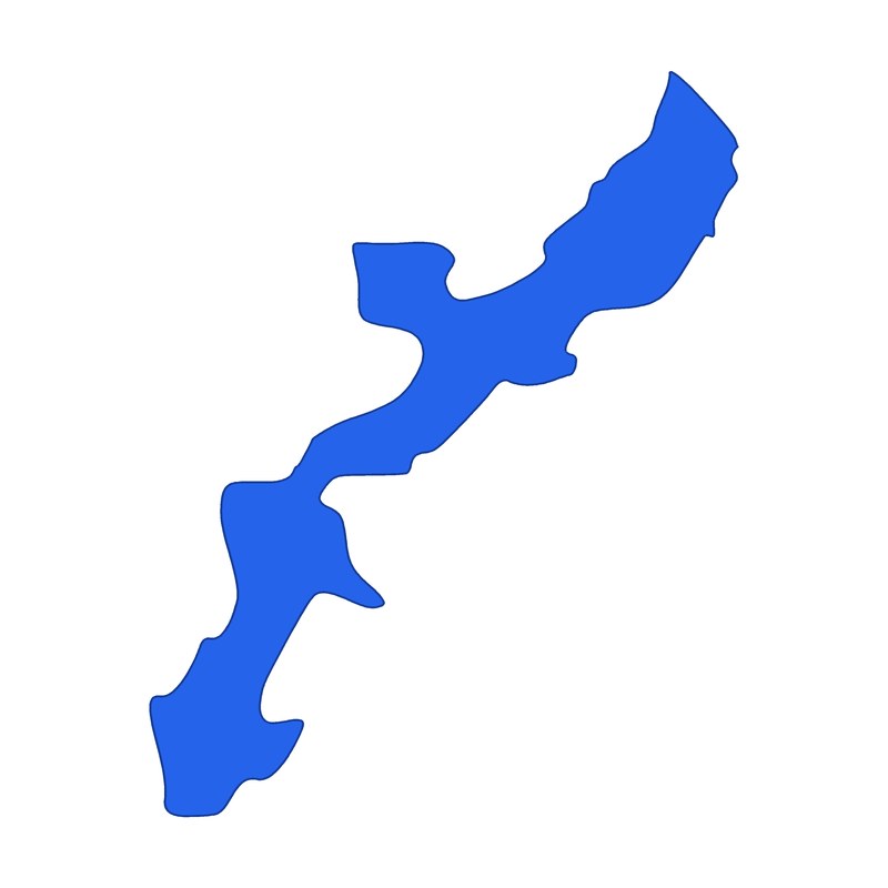 Okinawa
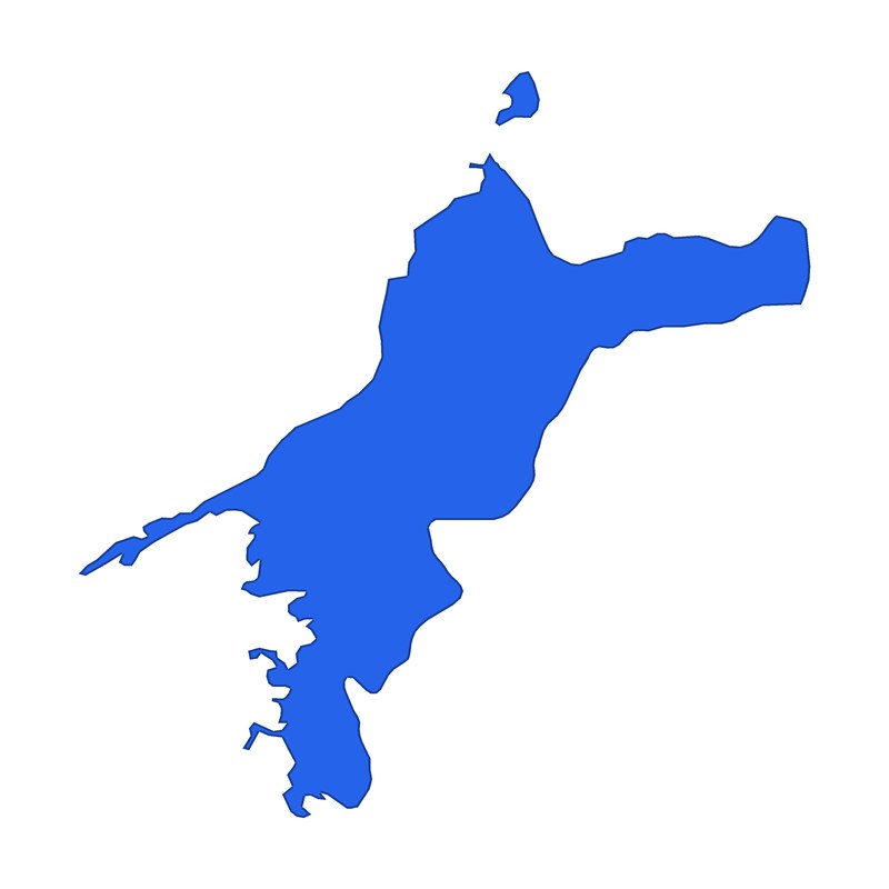 Ehime
Which one is the shape of Fukuoka?
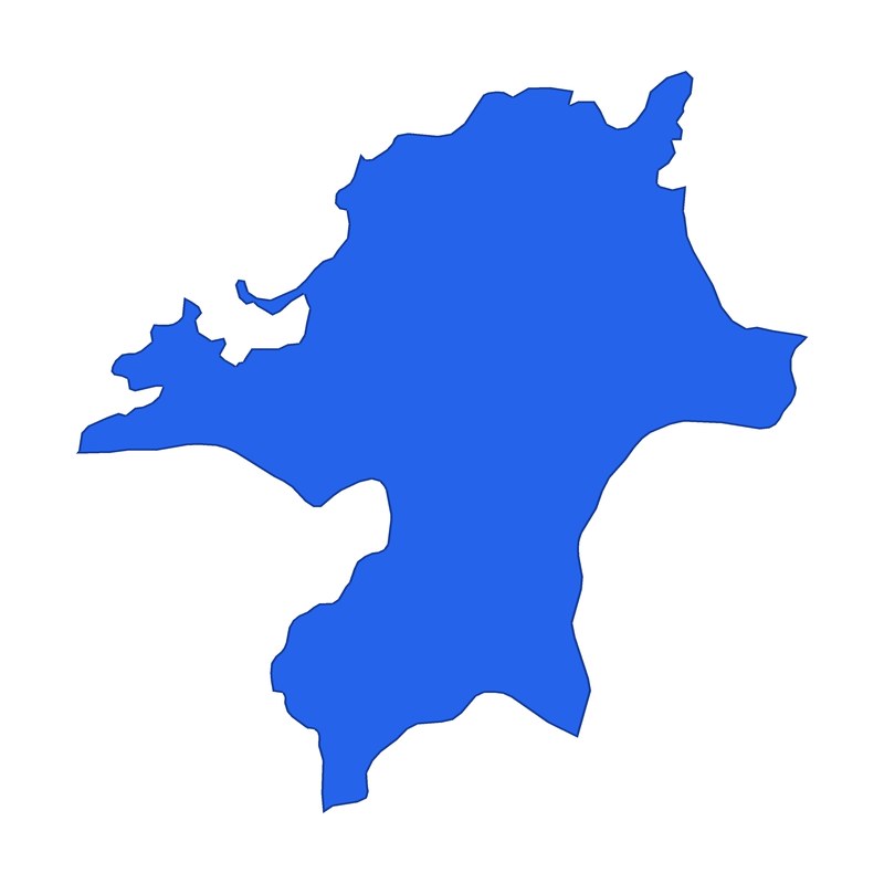 Fukuoka
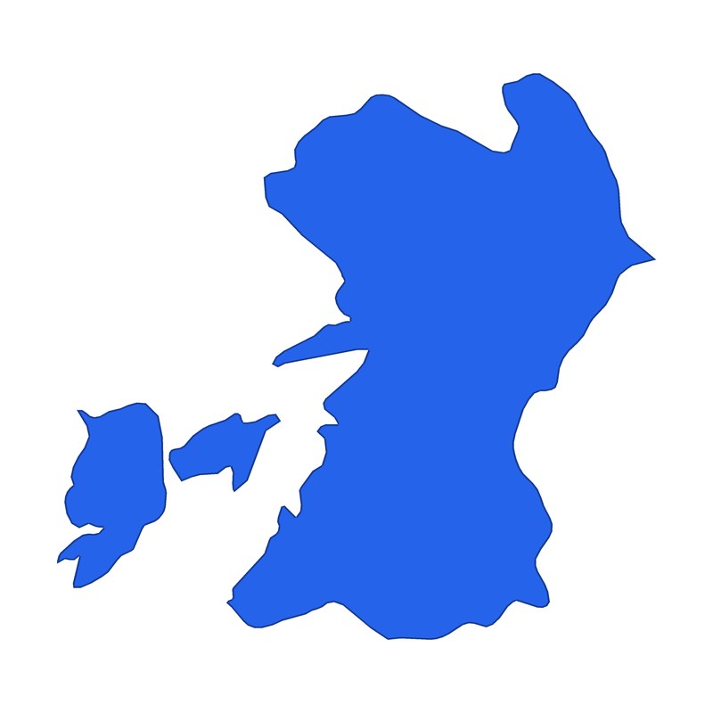 Kumamoto
- Miyazaki
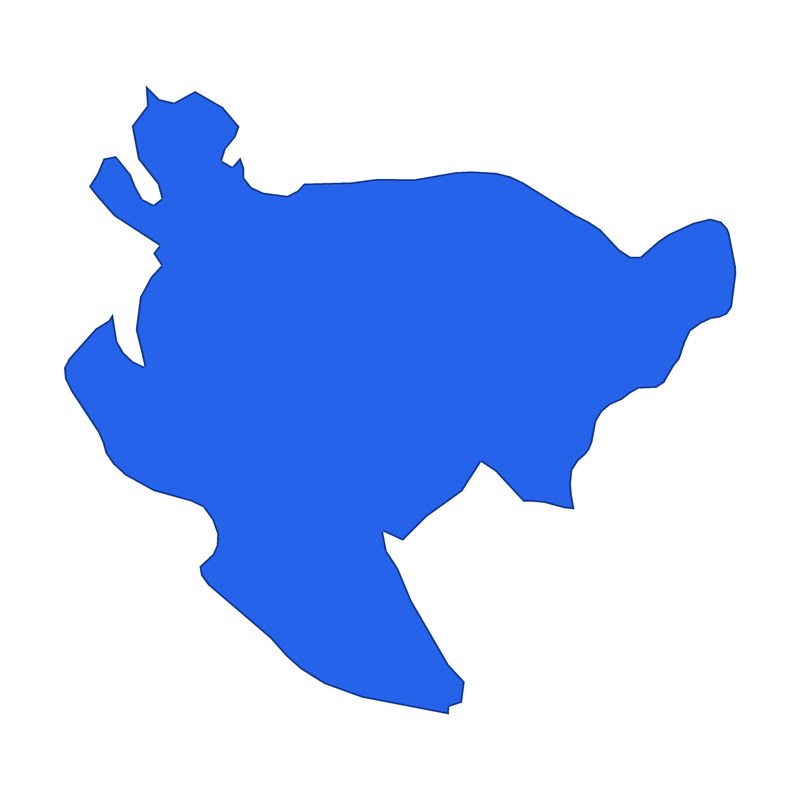 Saga
Which one is the shape of Niigata?
- Fukushima
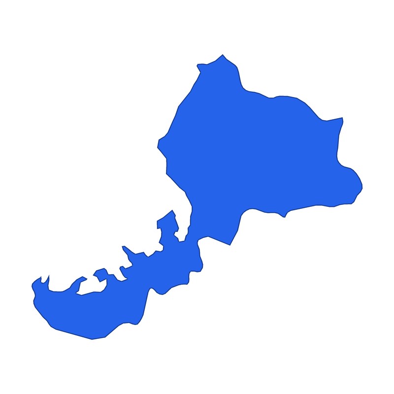 Fukui
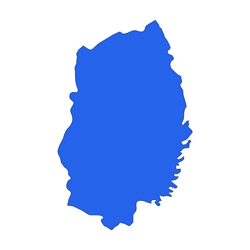 Iwate
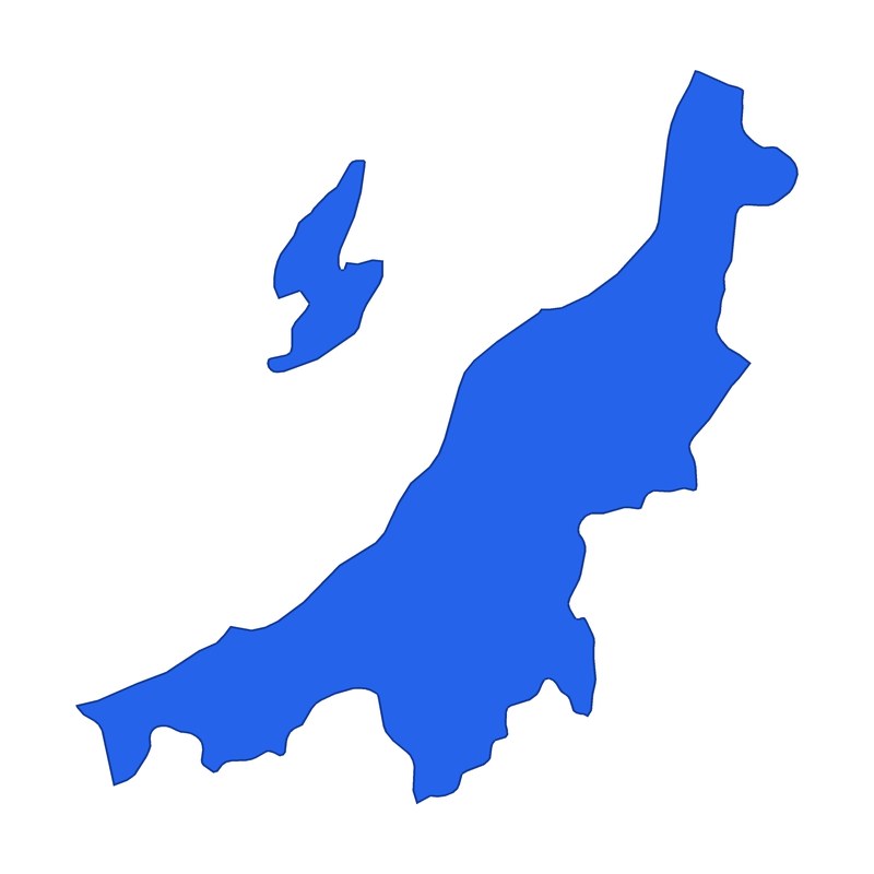 Niigata
The pictures are simplified from real maps, and far-off islands are left out. Okinawa is only the main island of Okinawa.
Prefectural capitals quiz
6 capital questions
What is the prefectural capital of Shimane?
What is the prefectural capital of Ehime?
What is the prefectural capital of Hyogo?
What is the prefectural capital of Gunma?
What is the prefectural capital of Kagawa?
What is the prefectural capital of Tochigi?
Many prefectural capitals share the prefecture's name, but some do not. Leaving Tokyo aside, 18 prefectures have a capital with a different name (counting Saitama, whose capital is written in hiragana as さいたま). The trap in this round is that the capital is not always the biggest city.
Border quiz: which border is the red line?
6 border and geography questions
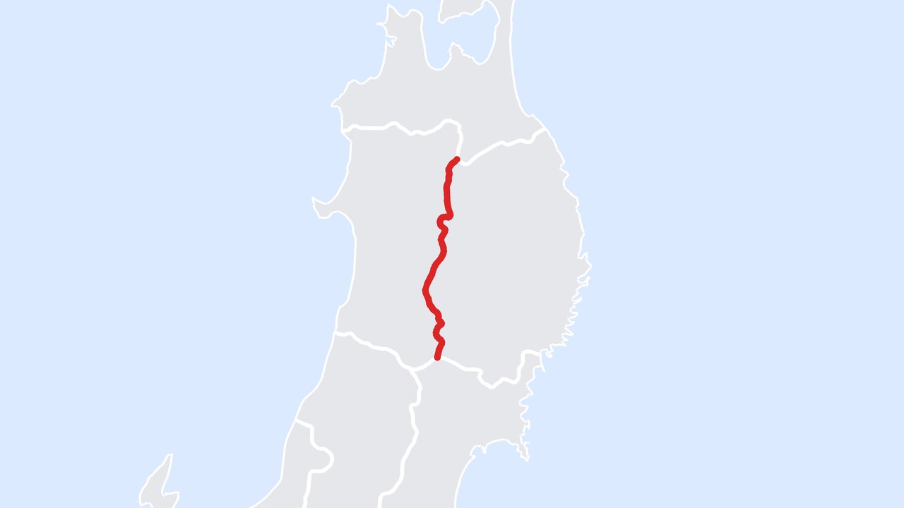
Which two prefectures does the red line separate?
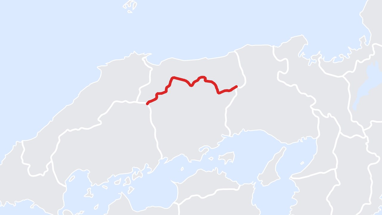
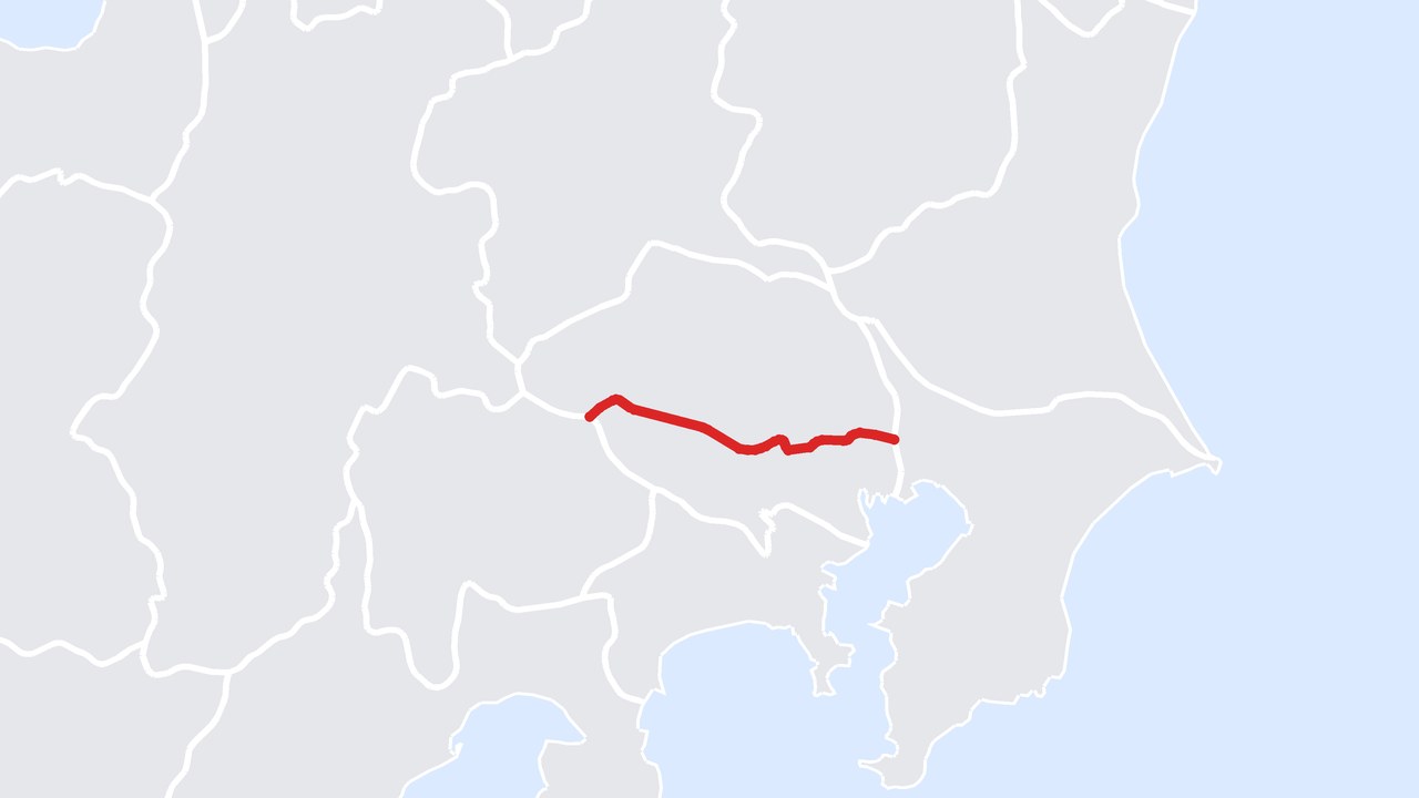
Which two prefectures does the red line separate?
Mount Fuji straddles which two prefectures?
Which two prefectures does the red line separate? (Tokyo is a metropolis, but the line is still called a prefectural border.)
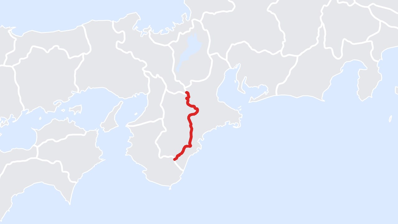
Which two prefectures does the red line separate?
Which prefecture shares a land border with the most other prefectures?
Prefectural borders often follow mountain ridges and rivers, so a good look at the map shows you the land itself. For the red-line questions, use the coastline and peninsulas around it as clues. The maps are simplified drawings that show where each border lies. For more map questions, play the 12-question border quiz (in Japanese) as it is. All the maps are drawn from Natural Earth map data (public domain).
Local specialties and landmarks quiz
6 local specialty questions
Sendai, famous for grilled beef tongue and sasa-kamaboko fish cakes, is in which prefecture?
The active volcano Sakurajima, which still sends up smoke, is in which prefecture?
Which prefecture is known for pressed trout sushi (masu-zushi) and for the glowing firefly squid that gather in its bay in spring?
In the Edo period, rice and goods from all over Japan gathered in a city nicknamed "the nation's kitchen". Which city?
Beppu and Yufuin, two famous hot spring towns, are in which prefecture?
Dejima, the artificial island that held the Dutch trading post in the Edo period, is in which prefecture?
Local specialty questions tend to bring up travel stories and regional dishes. After each answer, ask "Have you been there?" and the memories start flowing.
Tips for running a prefecture quiz
- For fourth-grade social studies review, start with the shape round. Many Japanese elementary schools teach the names and positions of the 47 prefectures in fourth grade. A white-background silhouette is a good way to recall the shape from the atlas.
- In care homes, let teams talk it over. Read one question at a time and let each table share a tablet. Stories about trips, hometowns and old workplaces come up naturally and the conversation grows.
- To make it harder, add more border questions. Even adults who are good at shapes find it hard to name a border from a red line alone. To make it easier, drop to three options when reading aloud.
- Add a word after each answer. The short explanation after each question mentions a peninsula or a mountain range on the border, which is a good reason to open the atlas.
How do I turn these questions into a quiz?
Is the prefecture quiz for elementary school children?
Can I use it for care-home activities?
Are the silhouettes the same as the real map?
Can I print the quiz?
Make a prefecture quiz with AI
Type a topic and a complete quiz with explanations is ready, and you can host it live right away. Players join from any phone with a PIN.
Create a quizSigning up is free. Players do not need an account.
Related articles
Flag Quiz: 24 Questions and Answers, Easy to Hard
Guess the flags of the world from their shapes and colors.
Quizzes for Seniors: 30 Easy, Fun Memory and Brain-Training Questions
A set of brain training questions with answers for care homes and family gatherings.
How to Create a Quiz with AI: 3 Ways
From a topic, your own notes or a PDF, a quiz takes about a minute.